Current Temperature
-26.1°C
Highway 3 twinning gets scrutinized at open house
Posted on July 5, 2017 by Taber Times TIMES FILE PHOTO
By Trevor Busch
Taber Times
tbusch@tabertimes.com
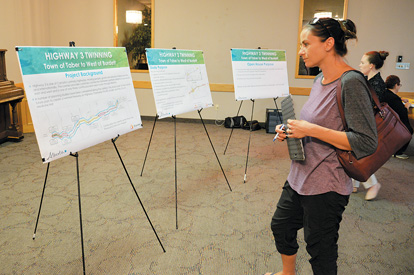
The province has launched a planning study on the future twinning of Highway 3, and local residents were invited to an open house on the preliminary stages of the study last week.
“The Alberta government is looking to complete a functional plan for the future twinning of Highway 3. What we’re doing is part of a future plan from Medicine Hat all the way to the B.C. border,” said Rhonda Shewchuk, transportation sector lead with Stantec Consulting Ltd., the firm contracted to conduct the study. “The open house is really just to introduce the study, let people know what the timelines are, what the process is, and just get some feedback, input, any concerns, any issues — anything we need to know before we go too far into the study and start developing options.”
The Functional Planning Study — currently underway — will identify staged options to upgrade the existing four-lane urban divided and two-lane undivided highway to a twinned freeway corridor designed to achieve National Highways System standards consistent with previous planning initiatives on Highway 3.
The segment being studied extends from the western boundary of the Town of Taber to west of the hamlet of Burdett. The target date for completion of the study is Nov. 30, 2018.
The existing short twinned segment passing through the Town of Taber, and the undivided segment through the hamlet of Grassy Lake are likely to be re-aligned through bypass routes to enable conformance with NHS standards. Access corridors to the freeway in this area will be through an estimated five interchanges. Shewchuk reported most of the initial feedback from the public has been largely positive.
“For the most part, it seems quite positive. I know there’s been talk about the re-alignment around Taber, but for the most part it’s been a positive response. I think people understand the safety through town with pedestrians, people crossing the street, and having a free-flow facility highway is maybe not the safest. So from that perspective, it seems quite positive. You never know where everyone is going to sit. It does impact landowners, but we’ll try to mitigate and minimize those impacts as best we can.”
The Alberta government retained Stantec Consulting Ltd. to complete a planning study for the future twinning of Highway 3. The study will identify staged options to upgrade the highway to a twinned freeway corridor, and identify future interchanges. The study is guided by a Project Review Committee comprised of representatives from Alberta Transportation, the County of Forty Mile, M.D. of Taber, Town of Taber and the Village of Barnwell.
The purpose of the planning study is to identify potential future alignment options, identify ultimate interchange configurations and locations, develop interim access plans, review existing urban section improvements, prepare cost estimates and identify land requirements, and assess traffic safety and identify collision countermeasures.
Another open house is planned for fall of 2017, followed by another in 2018 after a recommended option has been determined, with a final report to be tabled in November 2018.
“Once we go here, we’ll take the feedback from the public, and we’ll start developing options, and we’ll go through and figure out which ones are actually feasible, and bring them back to the public in November,” said Shewchuk. “After that, we’ll get input again — it gives the opportunity for public to come back and give input on all the options that are presented, and then we’ll go in and do an option evaluation, more of a technical evaluation, and come out with the recommended (option). At that point we’ll come back to the public, likely in early 2018, and it will give them a chance again to actually review the plans again, the actual recommendation, and then give input again at that point.”
Although the planning study is now underway, Shewchuk was quick to point out local residents shouldn’t expect to see shovels hitting the ground anytime soon.
“It’s not part of the three year construction plan. Anything beyond that will depend on funding as well as priorities. It will be a staged approach, so you could see something like the twinning happening as a first stage, with intersections staying. The re-alignment could come in 20-plus years, 25-plus years down the road, and then at some point the interchanges would be beyond that. So it’s very much a staged approach — it won’t be from here all the way to a full freeway. It will give a chance to do some of the improvements as time goes on.”
Although sometimes land has to be expropriated for developments of this kind, Shewchuk noted this was usually a matter of last resort for the province, which tries to come to an accomodation with landowners.
“That’s land acquisition. Expropriation is something that they don’t go to lightly. They try to work with the landowner to see of they can come to an agreement. That doesn’t happen until they’re ready to construction. It’s a negotiation, and it can be a long process. We do try to minimize the impact as best we can. Something like that, we’re going to try to focus more on grid lines or blind lines, so that if there is a pivot, it’s kind of the edge of it not diagonally through. I don’t know if we can eliminate it completely, but we’ll try to minimize it and mitigate as much as we can to minimize that impact.”
A study completed in 2006 recommended future interchanges at Range Road 175 in Barnwell, Range Road 151, and Range Road 121, and, ‘areas of further study around Taber and Grassy Lake.’ Highway 3 is currently designated as a National Highway System “core route” as well as a Long Combination Vehicle corridor.
The planning study is part of an overall future plan to create a freeway on Highway 3 between the B.C. border and the City of Medicine Hat. The study is being conducted now to identify future land requirements. For more information on the study, please visit http://www.transportation.alberta.ca/6088.htm.
Leave a Reply
You must be logged in to post a comment.

